
New Study: Inequitable Patterns of U.S. Flood Risk in the Anthropocene
More loss expected from poor land use planning than from the direct impacts of climate change
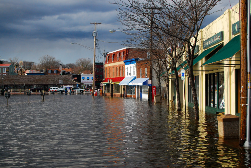
Flood risk in the United States is typically evaluated based on historical trends. Increasingly, these trends are no longer applicable to future flood conditions and risk. A new study in Nature Climate Change analyzes the changing flood risk landscape in the United States between now and 2050 and makes projections that could help inform decision-making and minimize future flood damage. It also assesses the social justice implications of which populations bear present and future flood risk. The study was produced by experts from the First Street Foundation, Wharton Risk Center at the University of Pennsylvania, Columbia University, the U.S. Army Corps of Engineers, and the University of Bristol.
Flood risk management requires long-term planning. This study indicates that the conditions of flood risk will change considerably between now and 2050. This makes forward-thinking analysis of changing flood hazard relevant even for a standard 30-year mortgage signed in 2022. Investors and mortgage lenders need to understand an asset’s flood risk through the lifetime of the investment, often decades into the future. An accurate understanding of the changing conditions of flood risk is necessary to sound decision-making today.
Existing efforts to model flood risk are largely insufficient to accomplish this. Currently, academic efforts to map flood hazard under climate change are in their infancy and are rarely used in commercial or regulatory applications. Local-scale studies tend to be the most accurate, of which FEMA’s flood mapping program is considered the gold standard. It is based on high-precision terrain data, fully surveyed river channels, local gauge information, and a full appraisal of local protection measures. However, these detailed analyses take considerable resources to carry out, and so their coverage has been relatively limited. Only one-third of U.S. rivers have been mapped by FEMA, and only one-quarter of those maps have been updated in the last five years. FEMA maps are also not required to account for climate change, a considerable oversight when assessing future risk.
The FEMA Special Flood Hazard Area (SFHA) is the de facto flood risk zone in the United States, made up of a patchwork of local FEMA flood maps. Areas within the SFHA are subject to various regulations on development. Those with a federally backed mortgage in these areas must purchase flood insurance. Properties located outside of the SFHA are commonly misconceived to be risk-free, but this is not the case. The study found that only 41% of the nation’s flood risk is located within the SFHA. Current flood risk is highly underestimated.
The study also found that flood losses in the U.S. are currently $32.1 billion per year on average. By 2050, climate change alone is expected to cause this number to increase to $40.6 billion. Across the term of a typical 30-year mortgage beginning today, this is a 26.4% increase in flood risk. This is a near-term climate impact that is essentially locked in – it will occur even if dramatic decarbonization were to happen immediately and should be accounted for in current decision-making. This climate-induced increase in flood risk is caused by intensifying rainfall and hurricanes, as well as sea level rise.
This increase in flood risk will not be felt equally across the nation. The study also examined the demographic components of flood risk across the U.S., focusing on race and poverty. It found that currently, poor and White communities are disproportionately likely to be subject to flood risk. However, projections up to 2050 show a different trend. In coming decades, flood risk is expected to increase disproportionately in predominately Black areas. These areas are highly concentrated in the Deep South in locations where climate change is expected to intensify risk.
Climate will not be the only factor that will impact changes to flood risk between now and 2050. As the U.S. population grows and development patterns change, demographic shifts are expected. The study also examined how much the flood-vulnerable population is expected to increase due to demographic shifts and climate change.
The researchers found that climate change alone, without population growth, would lead to an 18.6% increase in the number of people exposed to flood risk by 2050. Population growth in stable climate conditions would result in a much greater increase – 72.6%. This indicates that new development is expected to disproportionately occur in hazardous areas. In other words, as the population grows, an outsized number of people will move into floodplains. This leads to one of the most important takeaways from this report: without new policies to direct new development into safer areas, the contribution of population growth to flood risk will greatly exceed that of climate change.
Given this projection, the importance of improved flood risk management in the United States is clear. The authors of the study gave the following policy recommendations. More aggressive local land-use controls restricting new developments in the highest-risk areas, coupled with stronger building codes, could help lower the growth in flood losses. Such regulations on future development will need to be accompanied by investments in both relocation and retrofits for existing construction in areas where flood risk is high and/or growing. The federal government has several programs that currently fund such efforts, although not at the levels that will be required to fully adapt to increasing risk. Furthermore, several of these programs have been criticized for privileging more affluent and White communities. Equity-centered reform in light of climate change is needed for U.S. disaster policy – a call given greater emphasis by the demographic makeup of present and future bearers of U.S. flood risk shown in this study.
The authors of the study noted that current flood risk is evidence that there is a dearth of flood resilience in the United States in the status quo of climate and population demographics. The climate crisis will make this critical problem even more serious. The impacts described in this study are so near-term that decarbonization is futile in preventing them. The lack of quality, publicly available flood risk information has meant that risky development has proliferated across the US. It is critical that information on changing risks be made widely available and transparent to fully inform housing and mortgage markets to guide capital away from the riskiest areas. The findings of this paper provide important insights for communities and the federal government in designing future flood risk management interventions and in allocating federal dollars more effectively.
The full study can be found here.